Everything at a glance
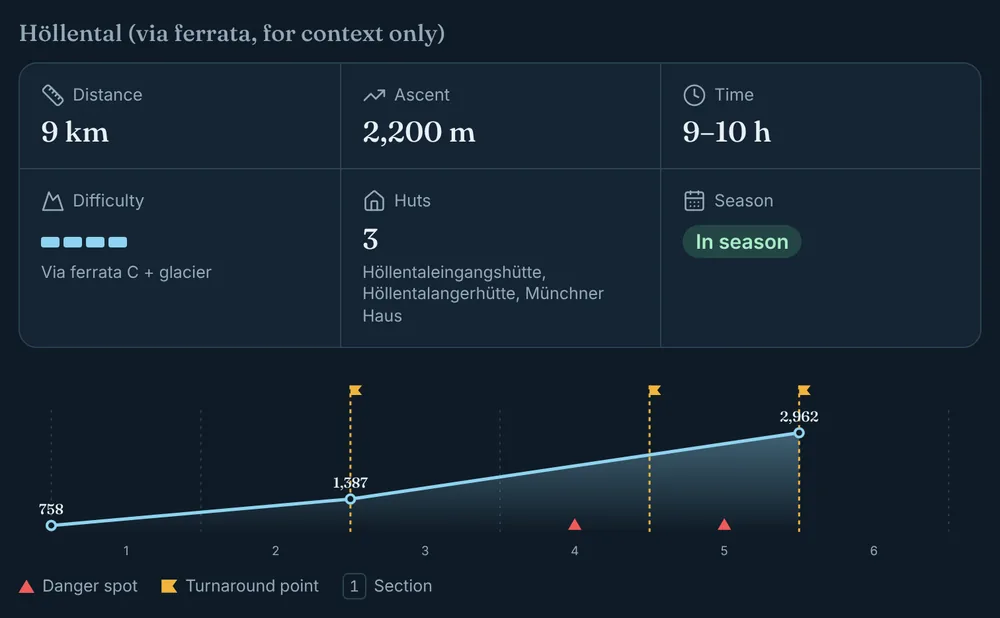
Distance, ascent, time, difficulty and season. The elevation profile shows danger spots and turnaround points.
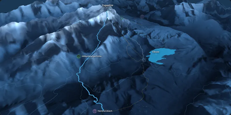
The route in 3D, the packing list for your date and clear rules on when to turn back. For your first big summit.
See the Zugspitze See what it looks like
Overview and 3D map free, no sign-up.

Distance, ascent, time, difficulty and season. The elevation profile shows danger spots and turnaround points.
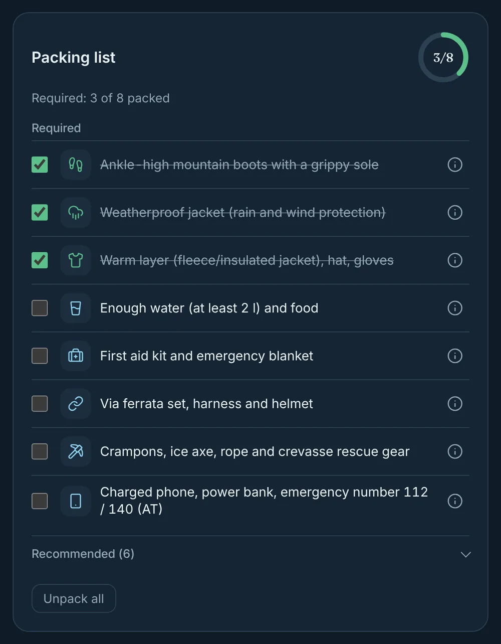
Required per route, recommended per season. Tick it off; stored only in your browser.
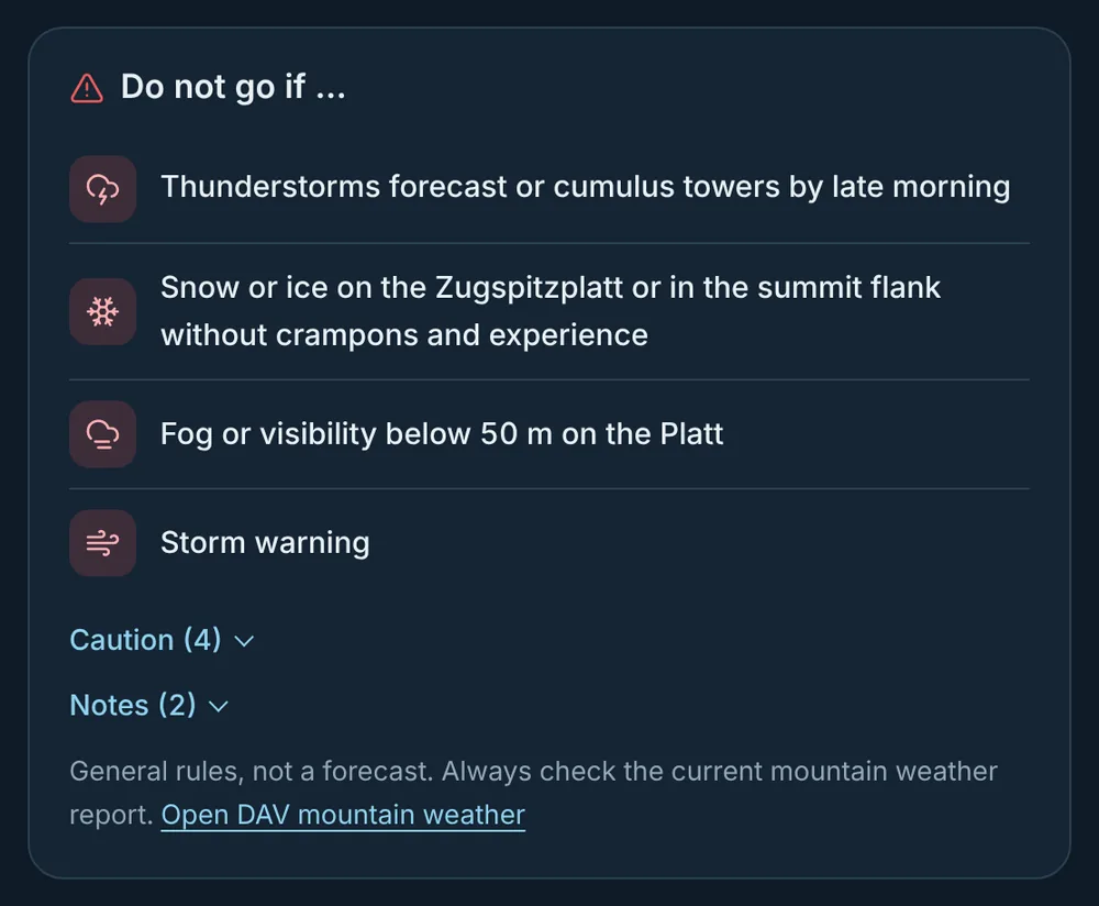
Thunderstorms, snow, fog, storm: clear rules instead of promises. With a link to the DAV mountain weather.
Only mountains with enough reliable sources. Every fact with its source and date.
No. alpin.studio helps you prepare. On the mountain you need a map, the trail markings and your own judgement.
No, nobody can honestly promise that. We show requirements and turnaround points; the decision is yours.
From the Alpine Club, huts, lift operators and tour portals. Every fact has a source and a date.
Yes, but in winter there is avalanche danger and the routes are no longer hikes. If you pick a winter date, we show a clear warning, links to the avalanche bulletin and avalanche gear in the packing list.
The iPhone app with offline access is in progress. Mountains you unlock will work there too.
Four routes with distance, ascent and time, plus the terrain in 3D. The overview is free.